Firefighting Operations – Warm Fronts, Tornados And The Dryline
As firefighters operate in the outside environment it is crucial they be able to understand the current weather conditions in their region, what is predicted in their area and how to read and understand the messages and data provided to them by the National Weather Service. This is part of the art and science of firefighting. As you have learned, having knowledge in these special categories helps to ensure a safe and effective outcome of your incident.
Today we wll discuss warm fronts, tornados and the dryline.
Warm Fronts
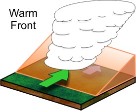
Warm fronts are often the focus of more steady rain and fog events though they can play a large part in tornado formation (a topic for a later date). Unlike the cold front, which often has a marked sharp boundary between advancing cold air and the warmer air ahead of it, the warm front is often more gently sloped in nature as seen in the graphic below.
Fog is often commonplace (especially during winter) just north of the warm front boundary along with steady rainfall or possibly snow as the warmer air is lifted above the cooler near-surface. This situation may also set the stage for sleet and or freezing rain during the cold season.
The Dryline
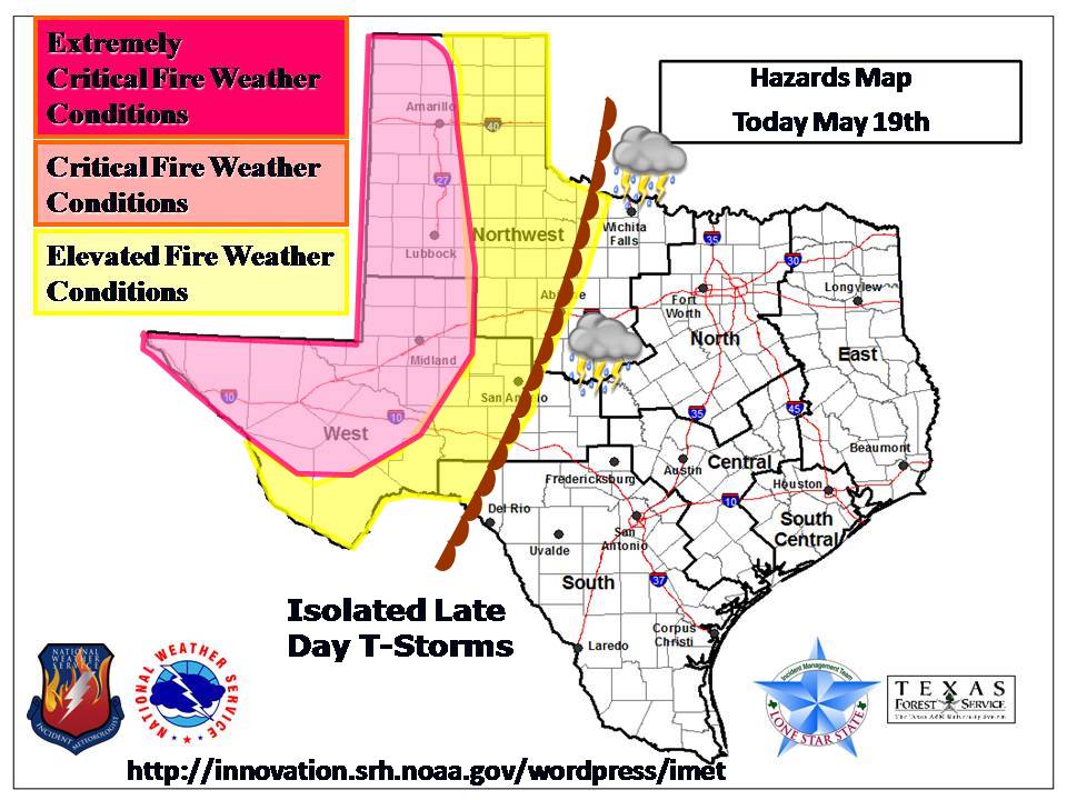
The dryline is a very important part of central plains weather forecasting. It separates drier air to the west from more moist air to the east.
The resulting effects on fire fighting personnel are two fold. Along and east of the dryline, thunderstorms are often possible; often severe with tornadoes, large hail, and damaging winds. To the west of the dryline, a classic setup for wildfires often exists with breezy westerly winds combining with very dry RH values as seen in our graphic.
Source: noaa.gov
In the example above, areas of fire weather concerns were outlined along with the threat location for thunderstorm activity. This setup repeats itself many times during the spring and occasionally into early summer. Next time we will put much of our lessons on weather together and learn about reading weather charting to help us with better weather predictions for firefighting operations.
For more reading on air masses and fronts, please see https://www.srh.noaa.gov/crp/?n=education-airmasses

