
Previous Story
Weather and Firefighting Ops – The Surface Chart
Posted On 18 Jan 2014
Comment: 0
As firefighters operate in the outside environment it is crucial they be able to understand the current weather conditions in their region, what is predicted in their area and how to read and understand the messages and data provided to them by the National Weather Service.This is part of the art and science of firefighting. As you have learned, having knowledge in these special categories helps to ensure a safe and effective outcome of your incident
Today we will learn how to interpret a surface chart. For long term fire department operatons, especially during growth type fires, knowng what symbology and understanding of the potential impacts on future operations is crucial for safety, logistics and planning.
Surface charts
Now that we’ve covered some of the basics of air masses and fronts, it is time to put some of that knowledge into practice. National Weather Service meteorologists create what is known as a surface analysis chart which is analyzed about once every three hours as in the example below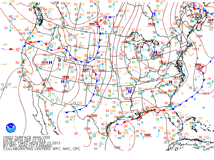
Source: https://www.hpc.ncep.noaa.gov/sfc/namussfcwbg.gif The surface analysis diagram makes it easy to ascertain where these airmass boundaries exist and thus what areas have the greatest risk of sensible weather which could influence fire operations.
There are many symbols on the chart which have not been discussed, but are summarized in the surface analysis, a simplified station model is used to depict the observed surface weather. Note that not all options will be presented.
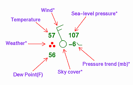
On US maps, the temperature and dewpoint are presented in degrees Fahrenheit.
The sea level pressure in millibars is coded in the following manner If the first digit is 5 or below, place a 9 before the reading and divide by 10. e.g. 807 is 980.7 millibars If the first digit is above 5, place a 10 before the reading and divide by 10. e.g. 107 is 1010.7mB.
Additional insight to surface analysis charts are available from the following resource:
https://www.hpc.ncep.noaa.gov/html/stationplot.shtml (Includes weather type symbols) https://www.hpc.ncep.noaa.gov/html/fntcodes2.shtm (include front symbols).
Watch these weather patterns change each day and note the movement with time. Take special notice of the characteristics of the airmass on each side of the boundary and see what types of weather are reported. With practice, you will likely begin to see trends develop.
This highlights one of the most important tools for short and medium term forecasting—pattern matching. While numerical forecasting methods (computer models) have made substantive improvements over the past few decades, they cannot be the sole ingredient to one’s forecast (if you want an accurate idea of what is to transpire.) Each computer model has it’s own biases and limitations.
While that is beyond the scope of our discussions here, it is important to note that these models are considered as “guidance” and not a true forecast in the purest form. Human input to forecast continues to outshine all forecast models in the short term because the human mind can recognize and interpret aspects about the weather that cannot be handled properly by models.
This is what makes National Weather Service forecasts such an important resource for the fire service. The NWS is the only place where sufficient computer AND human resources are merged to create the forecast in the USA. Get to know your local NWS office and establish a relationship with them. Take the time to establish a working relationship and trust. After all, the time to form these critical relationships is before an event occurs. If one waits until an ongoing event, it’s too late.
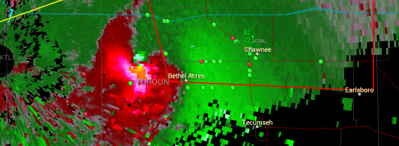
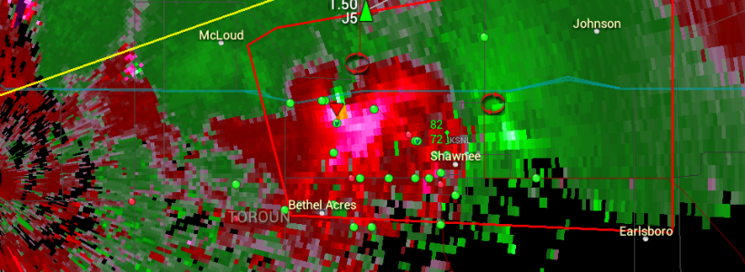
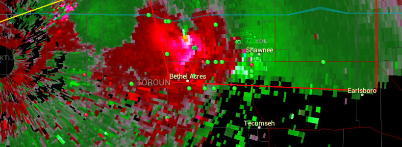
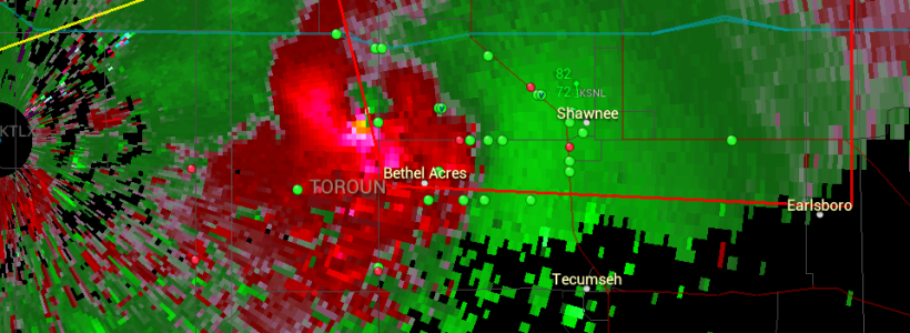
The cover and feature images are of the Shawnee tornado that struck in May 2013.
Images courtesy: PYKL3radar.


